Why straight lines in your locator map are shown as curves
When creating a locator map, you might want to import some lines. To do so, you can go to geojson.io, draw a line and then copy the resulting JSON snippet to our GeoJSON import in locator maps. 
But while the lines in geojson.io look straight... 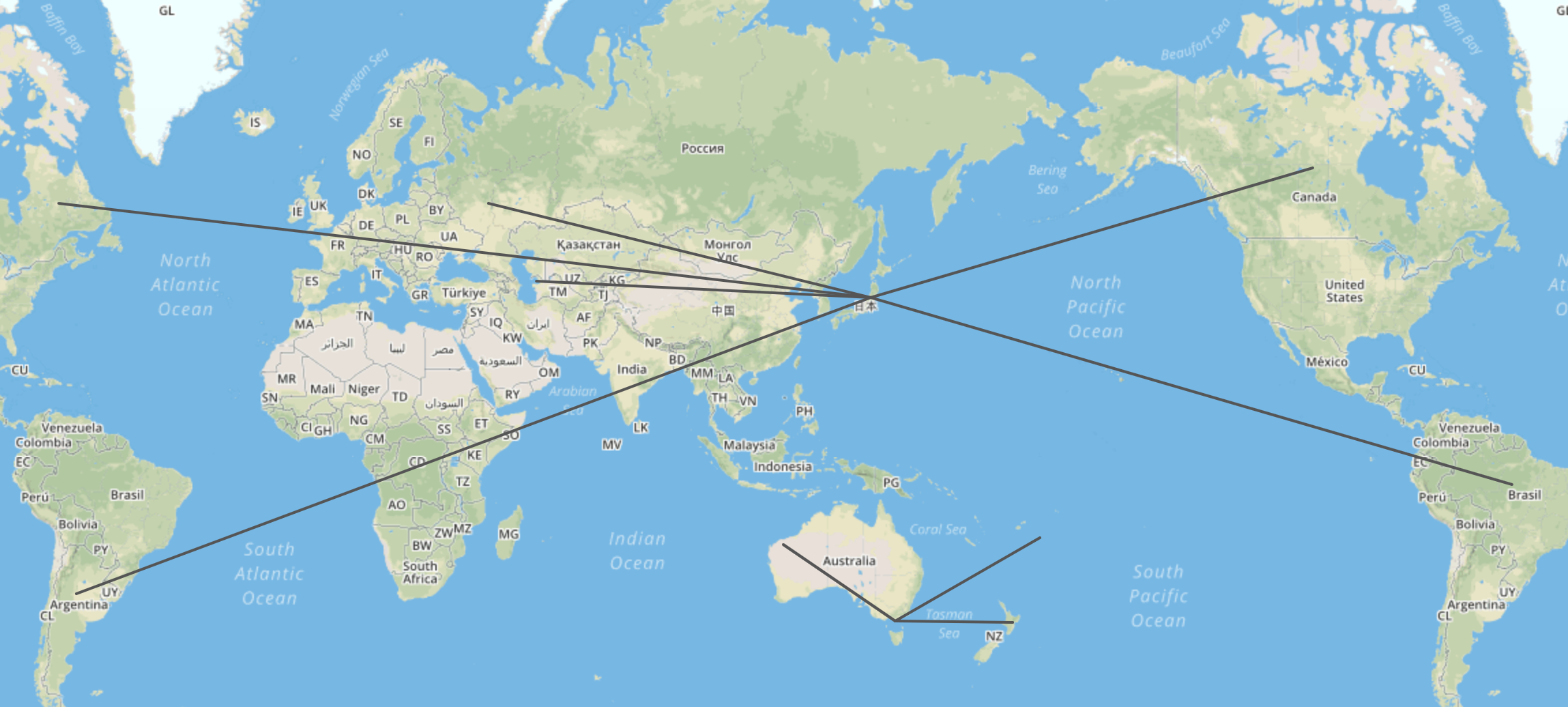 ...they will look curved as soon as you import them to Datawrapper:
You might wonder: Why is that?
It's because Datawrapper will show you the shortest possible line.
Here's how that works: A map is a sphere (the globe) that became two-dimensional. Wikipedia explains it well: "A map projection is a way to flatten a globe's surface into a plane in order to make a map. This requires a systematic transformation of the latitudes and longitudes of locations from the surface of the globe into locations on a plane. All projections of a sphere on a plane necessarily distort the surface in some way and to some extent."
Our locator maps use the Mercator projection. This works well for zoomed-in maps, but if you're showing entire continents the map will be distorted a lot. And because of this distortion, the straight line on a globe becomes an arc on a Mercator map.
You might have noticed that when taking a long-distance flight. The plane will take the shortest route, but what appears on your little entertainment TV in front of you looks like a big detour. It's easy to see these arcs over the Atlantic ocean or over Russia. This is what the shortest connection from London to San Francisco looks like on a globe (left) and on a Mercator map (right):
 In case you want to play around with these curves (geographers call them great arcs or geodesics), you can use the measure distance feature in Google Maps (make sure to switch to 2D view):

Why does my line go over the Pacific ocean?
A line is a connection between two coordinates. When you upload a line to Datawrapper, you're basically telling our tool: "Please find the shortest connection between these two coordinates." And that's what our locator map does.
But the shortest connection between two points is not necessarily the line you draw in e.g. geojson.io.
That's why a line that you draw like this...
 ...looks like this in our locator maps:

Why is my line not shown as a curve?
Lines on maps get curvy when they are long and go from the west to the east or the other way around. Here's are three reasons why your lines might be not curved:
Lines aren't shown as curves when they are short. As mentioned above, the distortion is only relevant when looking at small scale maps. Line segments that are shorter than 100km are shown as straight lines, like in this example:
Lines don't get curvy when they are very close to the equator. The further the lines are away from the equator, the more they will curve, because the more points on a map will be distorted when compared with a globe. Around the equator is almost no distortion, so the lines will appear straight like the red line here:
Lines don't get curvy when they go from north to south or the other way round. The more the longitudes differ, the curvier your line will be. If a line goes "straight down" on one longitude, the line will also appear straight in our locator maps.