How to add custom borders to locator maps
This article explains a workaround for uploading your own borders to locator maps for displaying disputed or missing borders.
Unlike symbol and choropleth maps, there is no option to upload our own custom base map on locator maps. The map data for locator maps comes from OpenStreetMap and is not customizable including borders and disputed borders. Where you draw borders is a sensitive topic, and sometimes the default borders on locator maps taken from OpenStreetMap data may not be the borders you'd like to draw in your specific map.
There is a way to upload your own custom border using a workaround. Here are the steps:
- 1
-
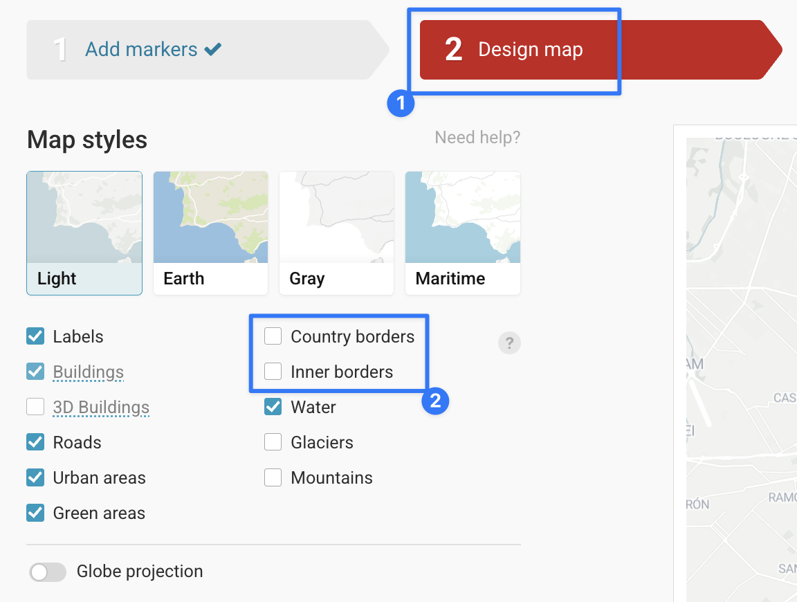
Turn off the default country borders, go to step 2: Design map > Map styles section and turn off country borders:
-

- 2
-
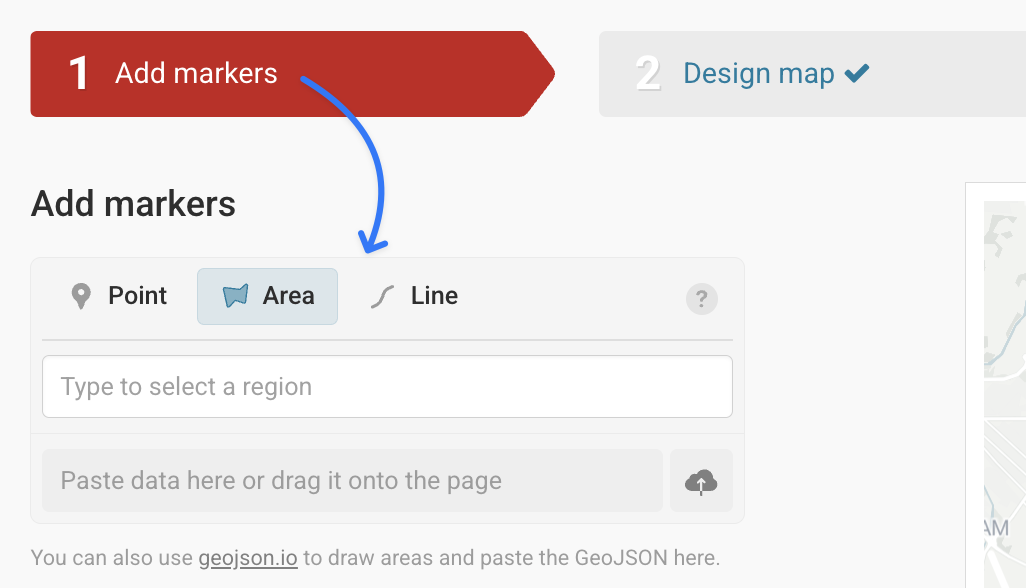
Import a GeoJSON file as a line or area marker and style it to look like the country borders. To read more about how to import line & area markers, read this Academy article here:
-

- 3
-
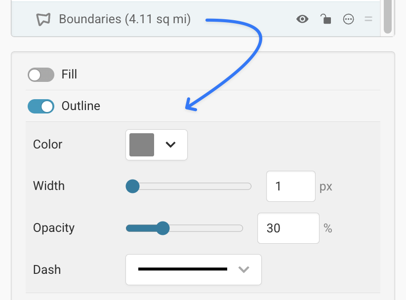
And then turn off the fill, and style the borders as you like:
-

If you have any issues putting together a custom JSON file or have any questions, reach out to us at support@datawrapper.de